Appearance
Creating a connection from file
Overview
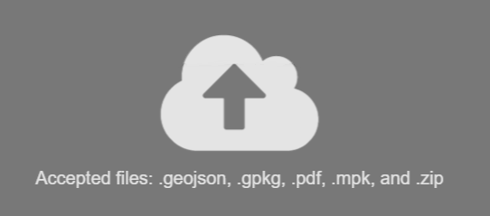
Spatial data is often packaged and distributed in the form of a spatial file. This might be a single file, or be multiple files in a compressed ZIP format (such as shapefiles).
Supported file types:
- Shapefile
- Geopackage
- GeoJSON
- File Geodatabase
- ArcGIS Map Package
- Geospatial PDF (Vector features)
Uploading from file
Method 1:
- Click the Create Connection "+" symbol, or select the Connections Tab and click New
- Click on the upload icon
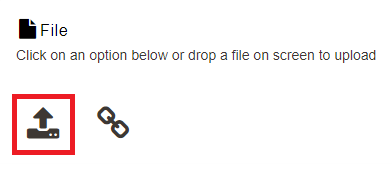
- Select a file from your computer
Method 2:
- Drag and drop file to the screen
Upload progress is displayed in bottom right corner of the browser.

Uploading by URL
- Click the link icon
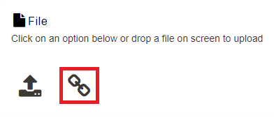
- Enter URL to file
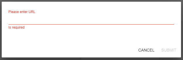
Upload progress is displayed in bottom right corner of the browser.
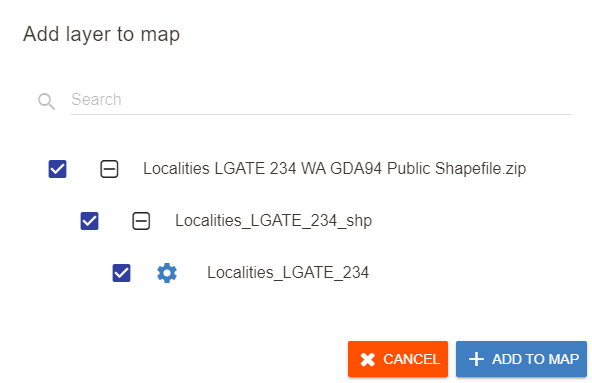
Adding directly to Map
Spatial files can also be directly added to an open map for a quick and easy way to view the spatial data.
To add a file directly to a map:
- Open a map
- Drag and drop the file into the map
The upload progress is displayed in bottom right corner of the browser.
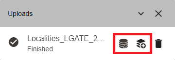
- After the file has been uploaded, click the left icon to configure the dataset or the right icon to add the layer to the map using the default configuration.