Appearance
Measurement Tool
Overview
The measure tool provides length and area information for individual features or hand-drawn polygons and lines.
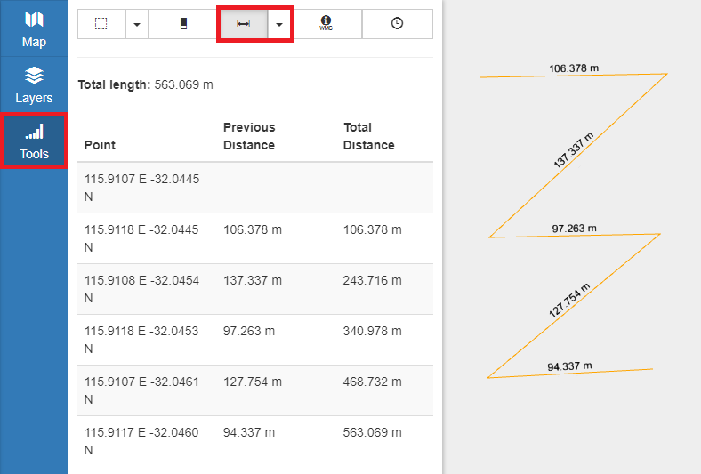
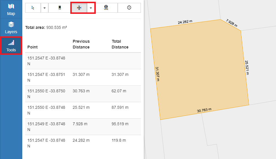
For distance and area measurements, both the distance and coordinates are displayed for each segment of the shape as well as the running total for segments up to each point.
Measurement options:
| Type | Description |
|---|---|
| Measure Distance | Free-form line with individual segment lengths and point coordinates |
| Measure Area | Free-form polygon area with individual segment length and point coordinates |
| Measure Target | Measures length/area of specific features, displays feature name |
Distance Measurement
The Distance Measurement tool allows the drawing of a temporary measurement feature on the map, displaying measurement and coordinate details for the drawn line.
To perform a distance measurement:
- In the sidebar, select the Tools Tab
- Click the Measure icon and choose a Measure Distance from the drop-down
- Single click on the map to place any number of points
- Double click to end measurement

Area Measurement
The Area Measurement tool allows the drawing of a temporary measurement feature on the map, displaying measurement and coordinate details for the drawn polygon.
To perform an area measurement:
- In the sidebar, select the Tools Tab
- Click the Measure icon and choose Measure Area from the drop-down
- Single click on the map to place any number of points
- Double click to end measurement

Targeted Measurement
The Target Measurement tool selects individual features for measurement, displaying area, length and name for the feature.
To select a feature for measurement:
- In the sidebar, select the Tools Tab
- Click the Measure icon and choose Measure Target from the drop-down
- Click on a feature
