Appearance
Layer Properties
Overview
Layer Properties contains various generic settings related to the layer as well as configurations for Automatic Level of Detail, Free Text Search and Clusters.
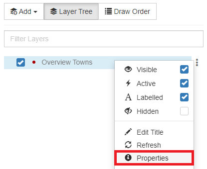
To access layer properties:
- In the layer tree, right-click the layer and select Properties
General Configurations
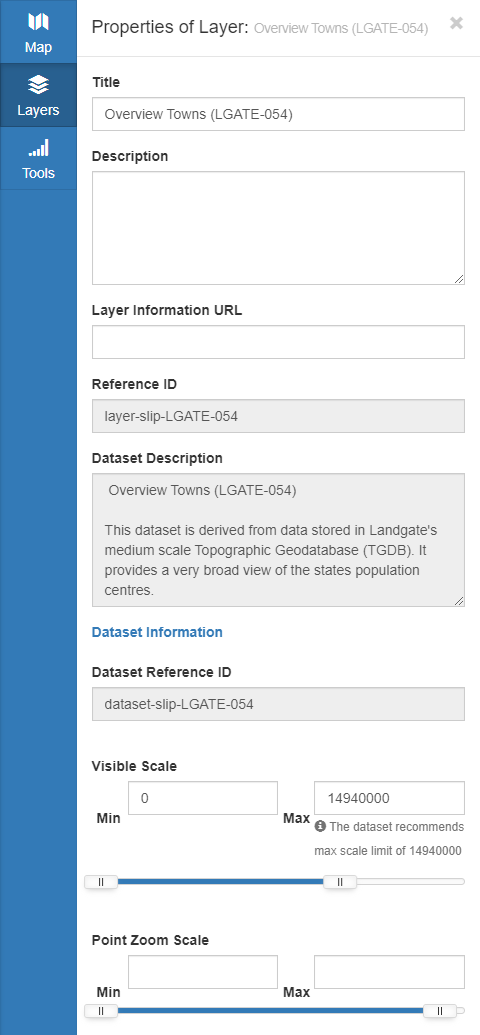
| Property | Description |
|---|---|
| Title | Title of the layer |
| Description | Basic information about the layer |
| Layer Information URL | URL to metadata regarding the layer |
| Reference ID | Unique ID which identifies the layer |
| Dataset Description | Basic information about the parent dataset |
| Dataset Reference ID | Unique ID which identifies the parent dataset |
| Visible Scale | Zoom scales where this layer will be visible. Changing this slider dynamically updates in the map so you get a live preview of the changes |
| Point Zoom Scale | Zoom scales to use when zooming to point features |
Automatic Level of Detail
Automatic Level of Detail reduces the visibility of small features to avoid clutter on the map and improve performance. The area of each polygon which would be visible in the current view is evaluated and features below the threshold are omitted.
📄 Note
Automatic Level of Detail is only available for polygon layers with the Derived Area field enabled.

Full Text Search
Configuration relating to Full Text Search:
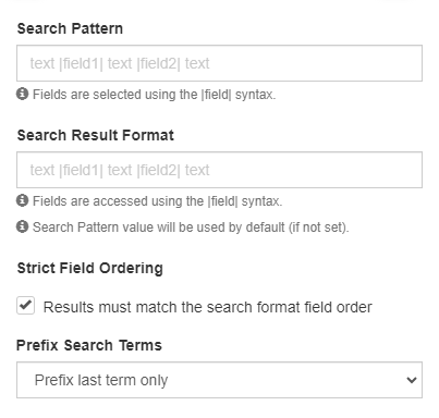
| Property | Description |
|---|---|
| Search Pattern | Pattern to search over in the map’s search bar |
| Search Result Format | How the search results will be displayed |
| Strict Field Ordering | Whether the user's search needs to match the Search Pattern |
| Prefix Search Terms | Which parts of the search input can be shortened |
Clusters
Configuration relating to Clusters:
📄 Note
Clusters configuration options will only appear for point layers.
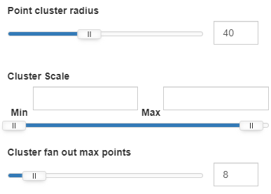
| Property | Description |
|---|---|
| Point Cluster Radius | Size of the capture area where points will be grouped together |
| Cluster Scale | Zoom scale range where clusters are used |
| Cluster Fan Out Max Points | Number of nodes which appear when a cluster is clicked |