Appearance
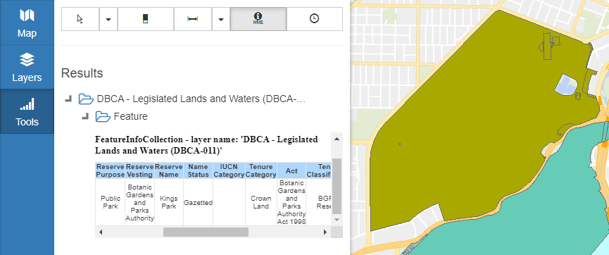
WMS Get Feature Info
A Web Map Service (WMS) layer makes requests to a server that provides georeferenced images. These are then displayed in Mapworks alongside other layers.
Unlike vector layers which can be left-clicked to display information, a "Get Feature Info" request must be sent to the WMS server along with the clicked coordinates. The server then returns the data associated with that location.
To use WMS Get Feature Info:
- In the sidebar, select the Tools Tab
- Click the WMS icon
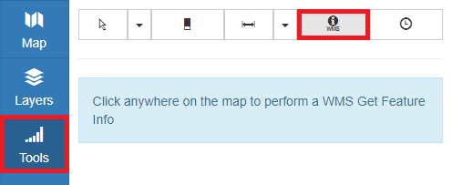
- Click on a WMS layer feature