Appearance
Creating a Dataset
Overview
Datasets define how a source of map data is brought into Mapworks and made available for styling, search, querying, and publication.
Most datasets are associated with a parent connection. Editable Datasets and Tiled Datasets are exceptions and do not require a parent connection.
See Creating a Connection for more info.
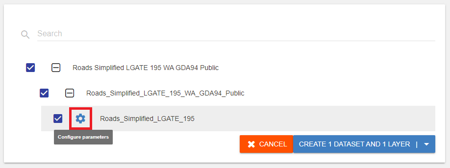
To create a dataset:
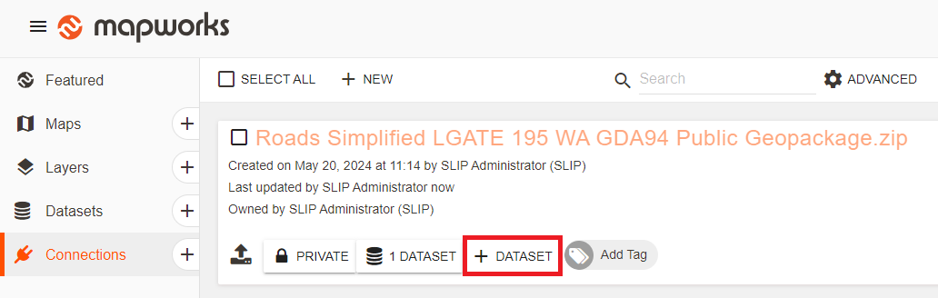
- Go to Mapworks UI
- Click the Connections Tab and search for the desired connection
- Click the Create Dataset "+" symbol
Alternatively:
- Go to Mapworks UI
- Click the Create Dataset "+" symbol, or select the Datasets tab and click New
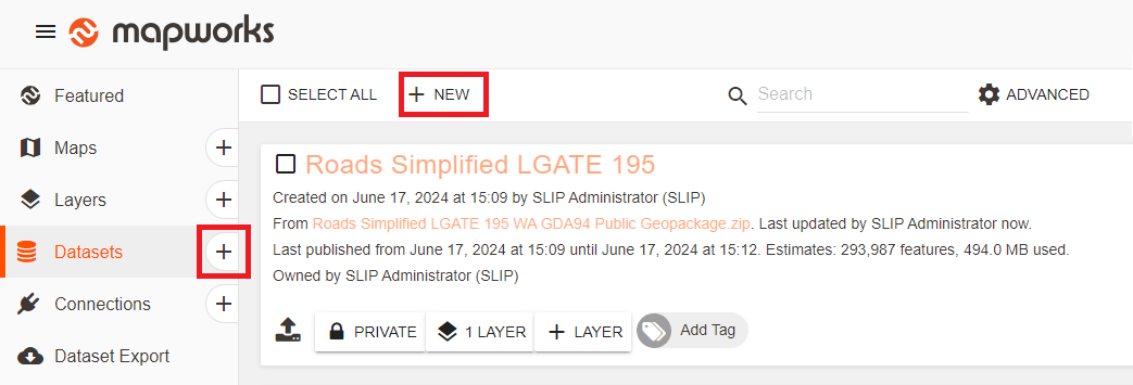
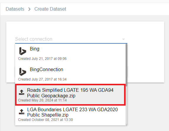
- Select a connection from the drop-down list
Before proceeding, it is important to configure parameters of the dataset as not all details can be adjusted later (Eg. Primary Key, Geometry, Live/Standard publication and availability of fields).
Dataset configuration
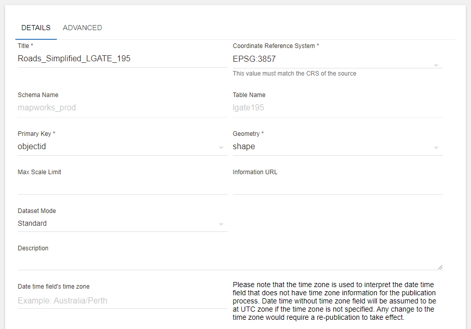
- Coordinate Reference System –
A coordinate reference system (CRS) is a coordinate-based local, regional or global system used to locate objects on a map. A CRS describes the way numeric coordinates are mapped to physical locations on the ground, noting that all CRS are approximate and most apply only to certain parts of the planet (and errors become large outside of the area for which they apply).
In terms of practical use, when loading vector data into Mapworks, you need to ensure the correct CRS is selected or your data will not appear in the correct location.
- Schema Name – Source schema or directory name
- Table Name – Source dataset name
- Primary Key – Unique field used to differentiate each feature in the map
- Geometry – Column within table that stores the geometric locations
- Max Scale Limit – Maximum zoom scale where the data is visible
- Information URL – Link to where more information is available from the owner of the data
- Date Time Field – Time zone used when interpreting data/time fields
Dataset mode
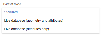
Dataset mode refers to how the data is updated / published.
Standard – Dataset will follow publication procedure (manual / scheduled). This is configured under Advanced dataset configuration
Live – Datasets are updated directly from the source database at short intervals
| Dataset mode | Description |
|---|---|
| Standard | Manual or scheduled publication |
| Live (geometry and attributes) | Dataset is updated live |
| Live (attributes only) | Only fields / attributes are updated live Geometry positions will not be updated |
Dataset Access
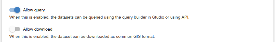
- Allow Query — When enabled, the dataset can be queried using the query builder in a map or using the API. Fields must still be marked Queryable & Thematics.
- Allow Download — Controls whether the dataset can be downloaded via the Mapworks API in common GIS file formats (Shapefile, GeoPackage, etc.). When disabled, the dataset can only be viewed within Mapworks maps.
Dataset Fields
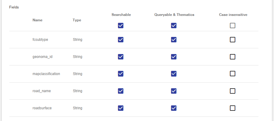
Fields are the columns found in the source table and can be individually configured to be available for different Mapworks utilities.
| Check Type | Description |
|---|---|
| Searchable | Refers to the Full Text Search bar in the top left of the map. Any fields containing information desired to be searchable or appear as a result must be set as searchable. |
| Queryable & Thematics | Must be checked to make fields available in the Query Builder and Thematics tool. |
| Case Insensitive | The field is indexed such that the capitalisation of letters will not affect any searching. This is only applicable to text string fields. |
Derived Fields
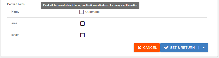
Mapworks generates area/length fields from the source data. This must be done during the initial dataset setup as these fields cannot be retroactively added.
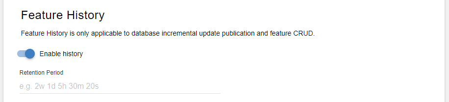
Feature History
For incrementally published datasets, Feature History can be enabled to provide a window where the old features are retained in addition to the newly updated copies for a period of time.
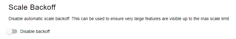
Scale Backoff
By default, Mapworks will automatically reduce the maximum visible scale for dense layers when performance becomes impacted. This can be disabled to ensure very large features are visible up to the max scale limit.
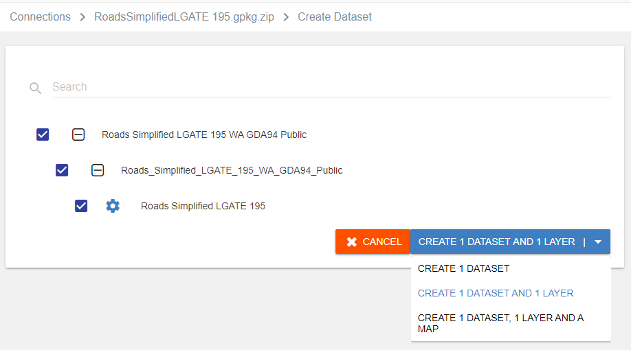
Create Options
Once the dataset is appropriately configured, click Set and Return and choose a create option.