
Appearance
Map Properties
Overview
Map Properties displays information about the map, including its description and metadata, and provides access to functions such as print and export.
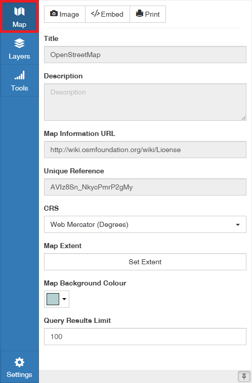
Title — The display title of the map
Description — A text description of the map written by the author
Map Information URL — Link to where more information is available from the owner of the map/data
Unique Reference — Automatically assigned unique ID which identifies the map and appears in the map URL (also known as Reference ID)
CRS — Coordinate Reference System
Map Background Colour — Background colour of the map
Map Extent — Defines the visible bounding box of the map and can be adjusted using the Set Map Extent panel
Query Results Limit — Maximum number of results listed when using the Query Builder tool
Map Extent
The Map Extent setting controls the area shown by the map. Click Set Extent to open the extent panel.
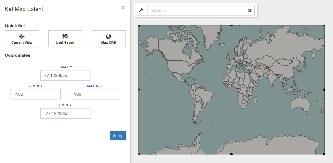
You can set the extent by editing the minimum and maximum X and Y values in the Coordinates section, or by moving the bounding box points shown on the map while the panel is open.
The Quick set options provide shortcuts for common extent settings:
- Current View — Uses the area currently visible on the map
- Last Saved — Restores the most recently applied extent during the current session
- Max CRS — Uses the maximum extent available for the selected coordinate reference system