Appearance
Labels
Overview
When configuring labels, there are two formats to consider:
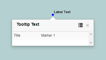
- Label Text – appears on the map within a polygon or adjacent to a point or line
- Tooltip Text – appears on mouse-over hover and appears as the title of the left-click pop-up
An example of a hovered feature:
An example of a clicked feature:

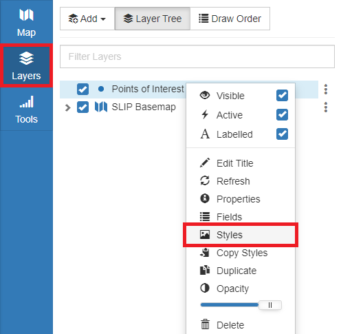
To configure Labels/Tooltips:
- In the sidebar, select the Layers Tab
- Right click the layer and click Styles

- Click the Labels Tab
Configuring Labels/Tooltips
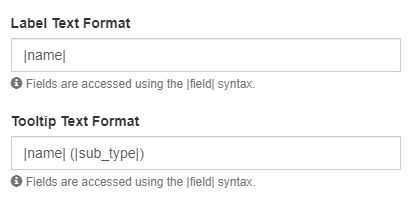
Field values can be accessed in labels by placing the field name within pipes. Any plain text included outside of pipes will appear as is. Other symbols such as brackets, $, % or degrees ° can be included as plain text as well.
In addition, new line characters can be included in both the label (using \n) and the tooltip (using <br>)

Labels can have a separate visible scale range to their layer but unless specified they will match the scale of the layer.
Placement refers to where a label appears oriented to it's feature (lines/points)
Overflow allows labels to be forced to be visible even if they would not fit inside the polygon at the current scale.
If multiple labelled features are in close proximity, Priority determines which labels are most visible when the view is cluttered.